Construction sites evolution
Save money and surveying time with high-resolution orthophotos captured with preprogrammed drone missions
With our W-LAB Drone mapping technologies, we can help construction and engineering companies with a cost-effective system to control regularly site works evolution, machinery, and material location.
We combine the 2D and 3D photogrammetry models to check the evolution of the site and keep our clients informed of the progress of the construction process.
-
All our Orthophoto maps are georeferenced and shared with our clients in GEOpacakge or GEOtiff format, compatible with GIS applications.
-
We can capture accurate 3D models using photogrammetry and deliver georeferenced Mesh models to perform analysis and measurements
-
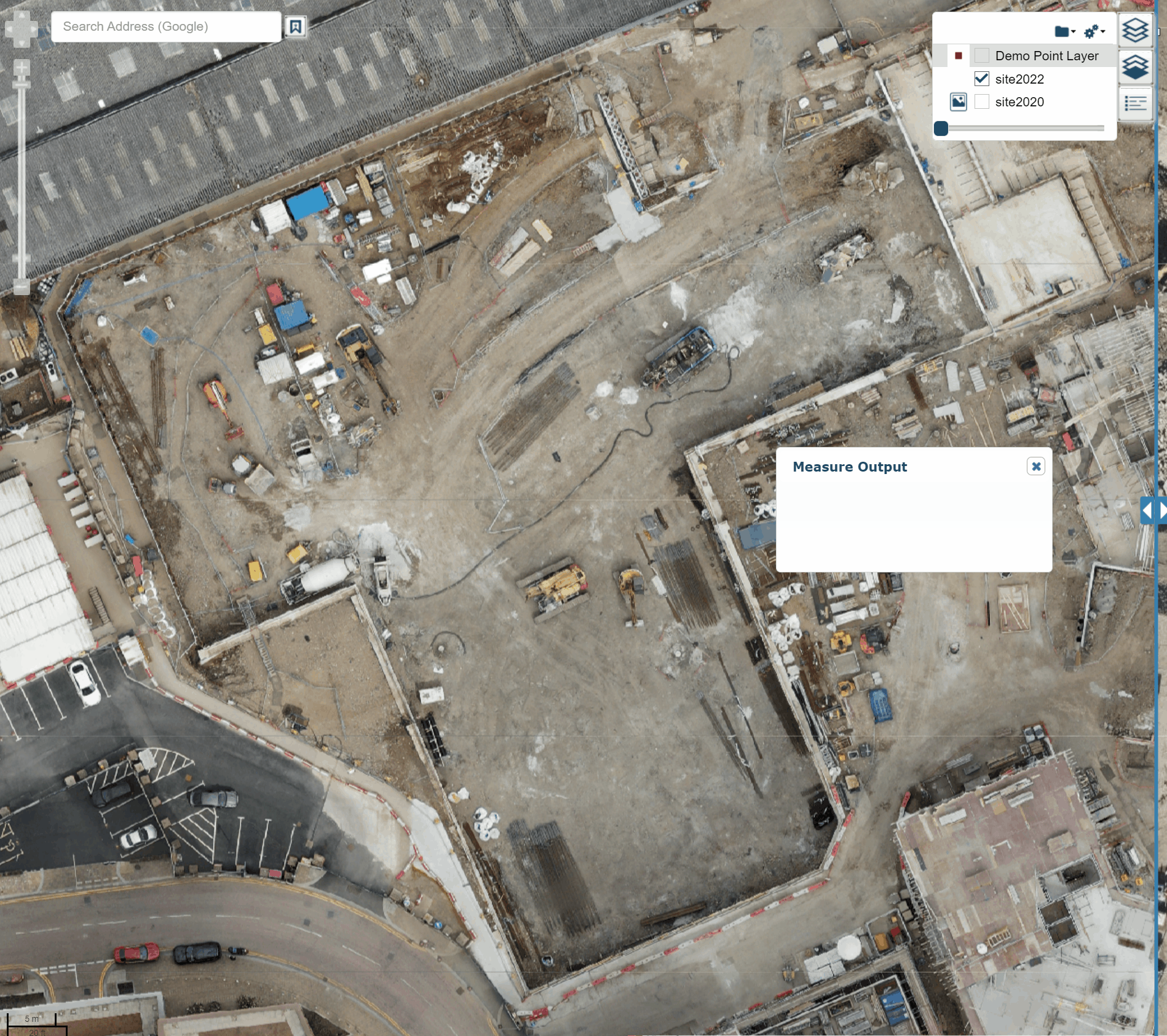
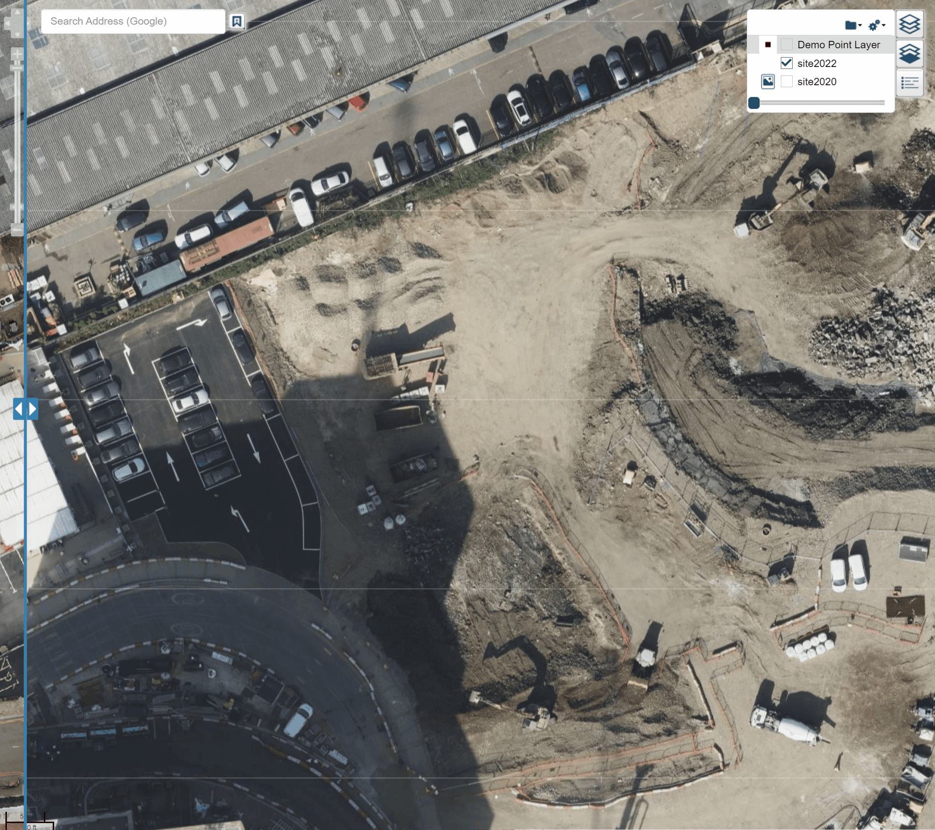
In the client area, you will find the results of each survey classified by date. Allowing measurements like Areas, distances and perimeters
Our outputs and workflows can be adapted to the specific needs of each project and client. Our services are flexible and can be shaped based on the demands of each situation. To know more please do not hesitate on contacting our team and we will be delighted to listen to you.

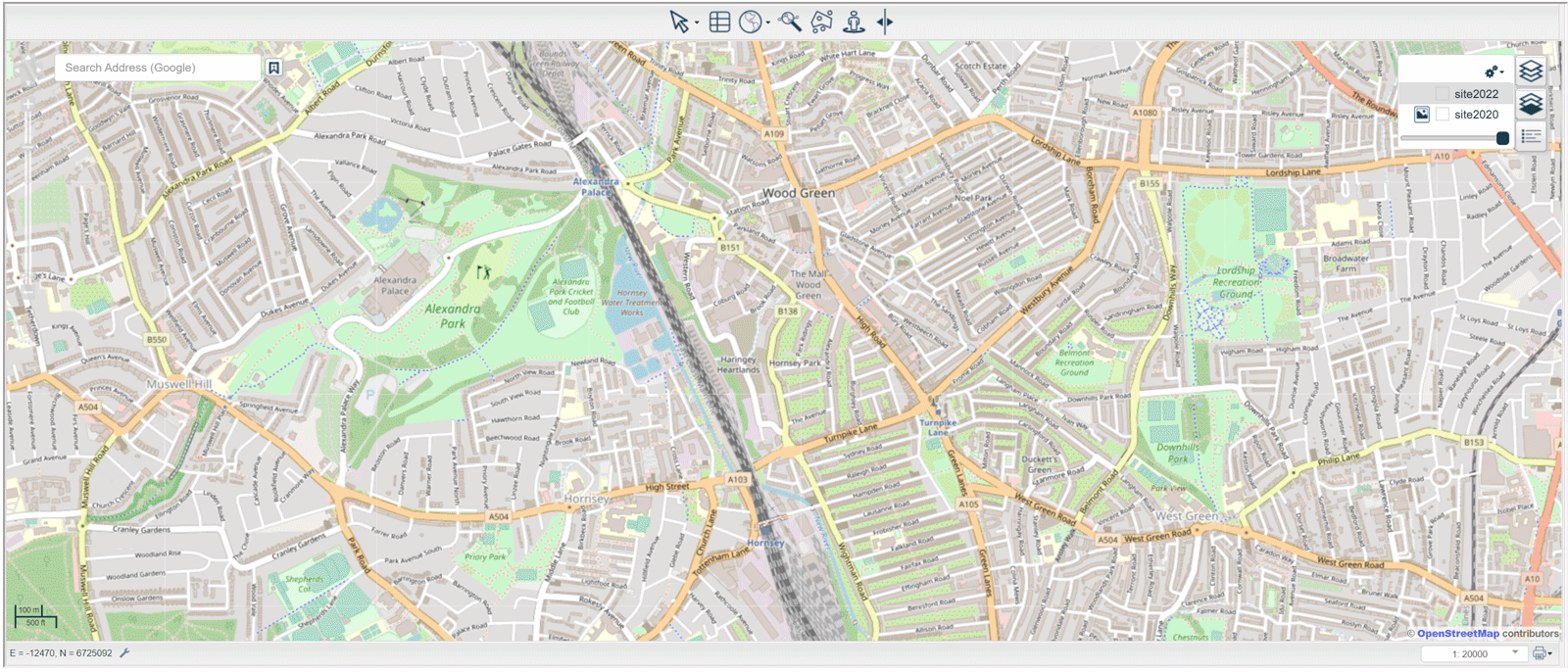
we create custom interactive maps
Once we have captured and processed the images to generate a georeferenced orthophoto we allow our clients to check the results in an interactive and intuitive map, within the client area.
Areas, perimeters and distances can be measured live. This will help you to get an understanding of the square meters of a plot or a surface. Just draw a polygon and the results will be instantly visible.
Check the evolution over time
Before and after comparatives are quite useful to understand the elements and areas that have been modified and understand if the construction works are meeting the scheduled calendar.
With aerial photogrammetry and 3D orthophoto maps, managing the evolution of a construction site is faster, safer and cheaper, allowing sur
Interact with the Orthophoto maps
Many clients like our maps because their interactive level and data set are easy to read. we don just deliver the image datasets, but we also like to take care of the way its presented. We have a client area where we can upload results and make them available at any time, completely private, where results and maps can be downloaded or printed directly from the interactive portal.