Interview at Onda Regional de Murcia
by Macu Alemán / 23rd of August 2022
Onda regional link to the web article
Listen to the interview in the link below.
Carlos Bausa Martinez
The Architect from Murcia (Spain) Carlos Bausá uses thermal images captured with drones to evaluate the heat island effect and help in planning urban spaces or allocating Residential blocks in areas with lower temperatures.
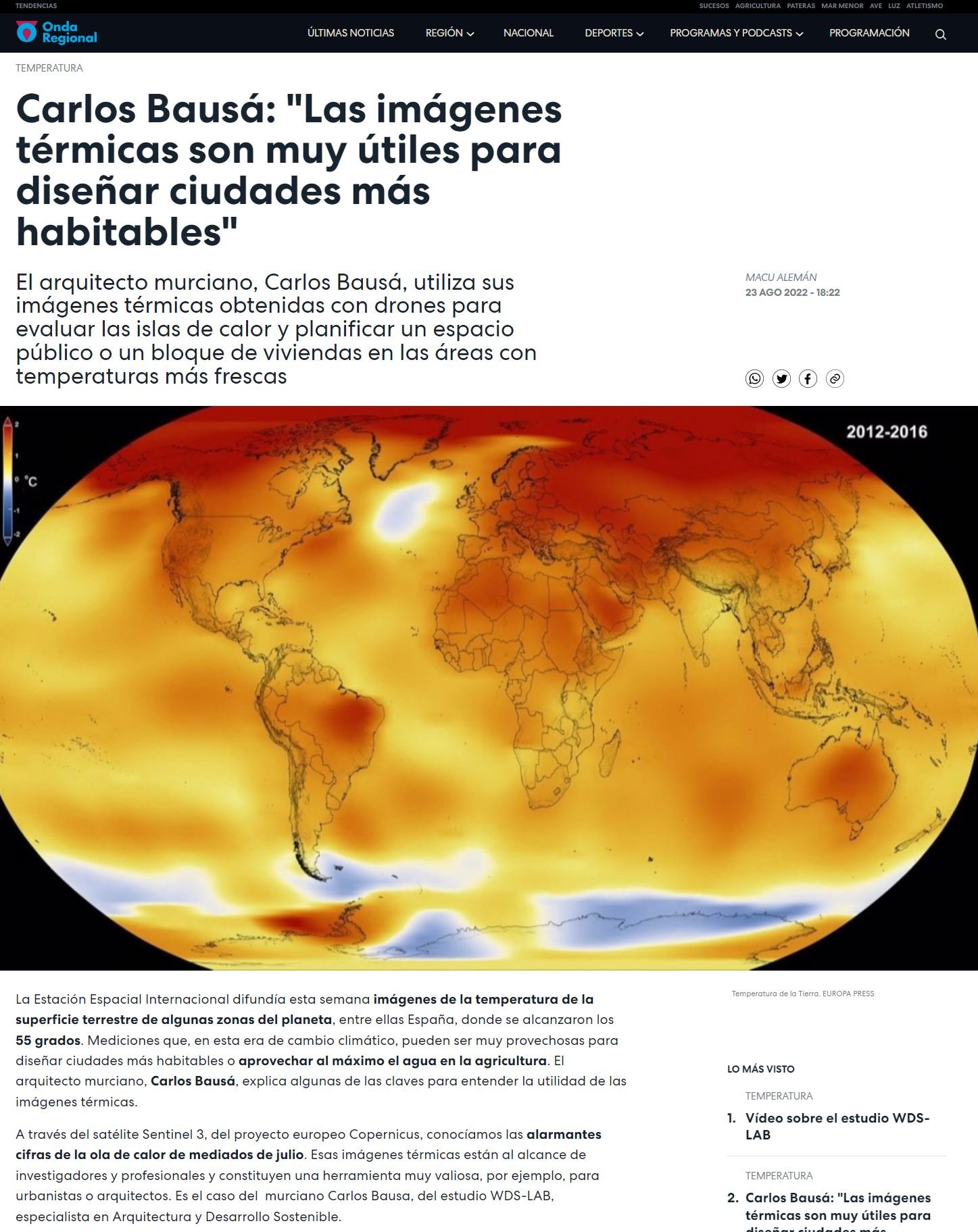
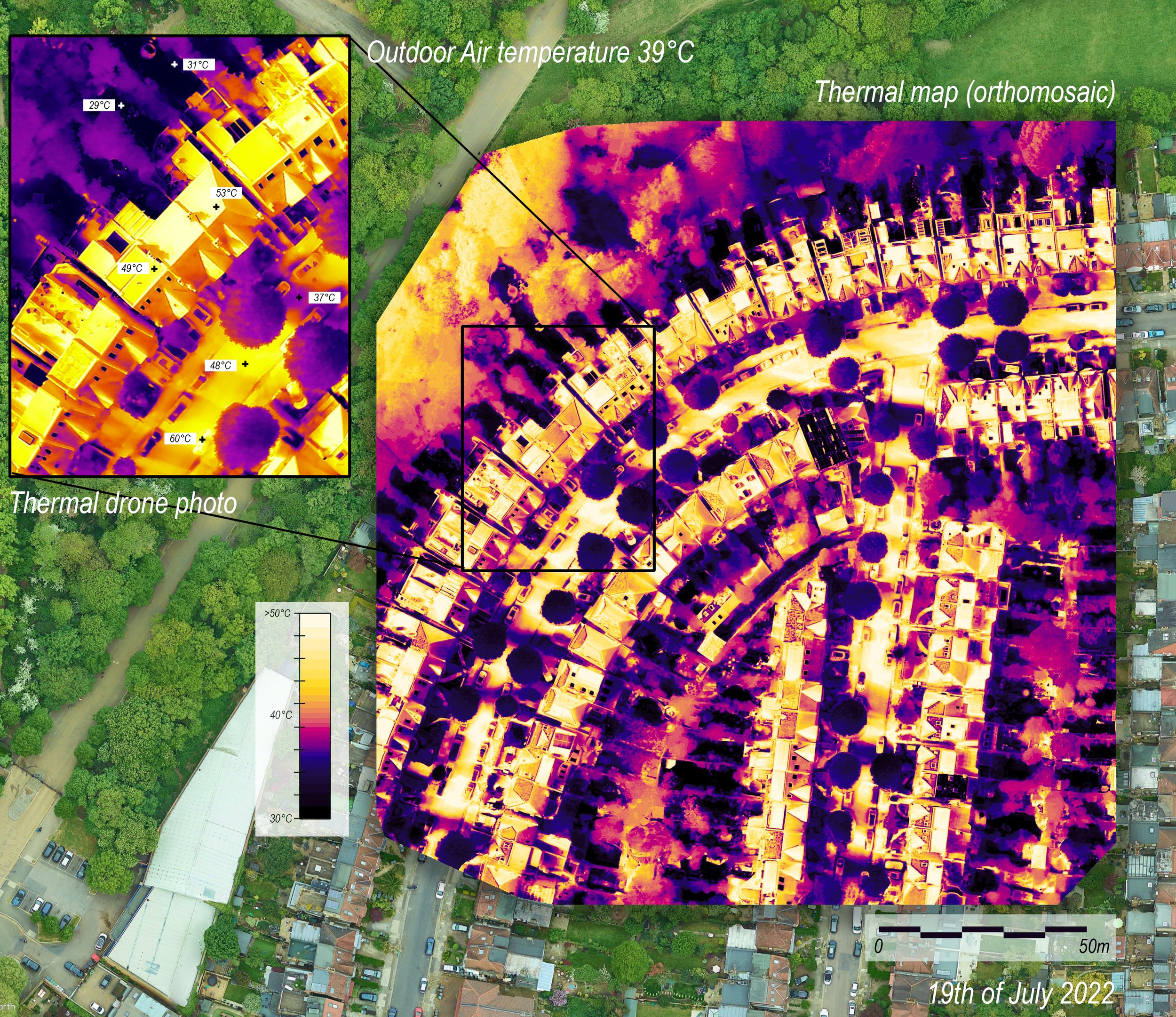
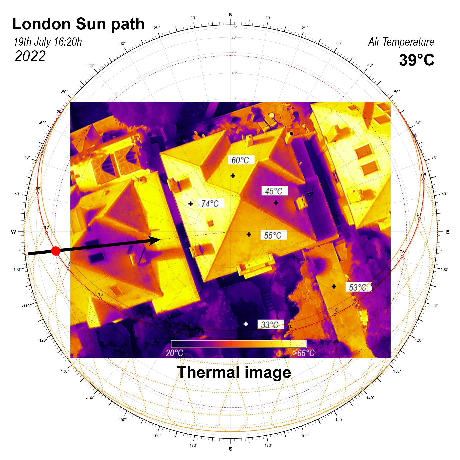
The European Space Agency released this week images of the surface temperatures reached in some areas of the planet. Among them there was Spain, where we can see some areas reached 55 degrees. These measurements in this climate change age, could be very useful to design more habitable cities, or take advantage to plan irrigation in agricultural land. The architect from Murcia, Carlos Bausá explain some of the keys to understand te utility of thermal imaging.
Through the Sentinel 3 satellite, part of the European Project Copernicus, we could find out the alarming figures, of the heat wave we experienced by mid july. These thermal images are at reach of researchers and professionals and have become a great and valuable tool, for instance for urban designers and architects. It’s the case of the Architect Carlos Bausa, cofounder of WDS-LAB, and specialist in Sustainable Architecture.
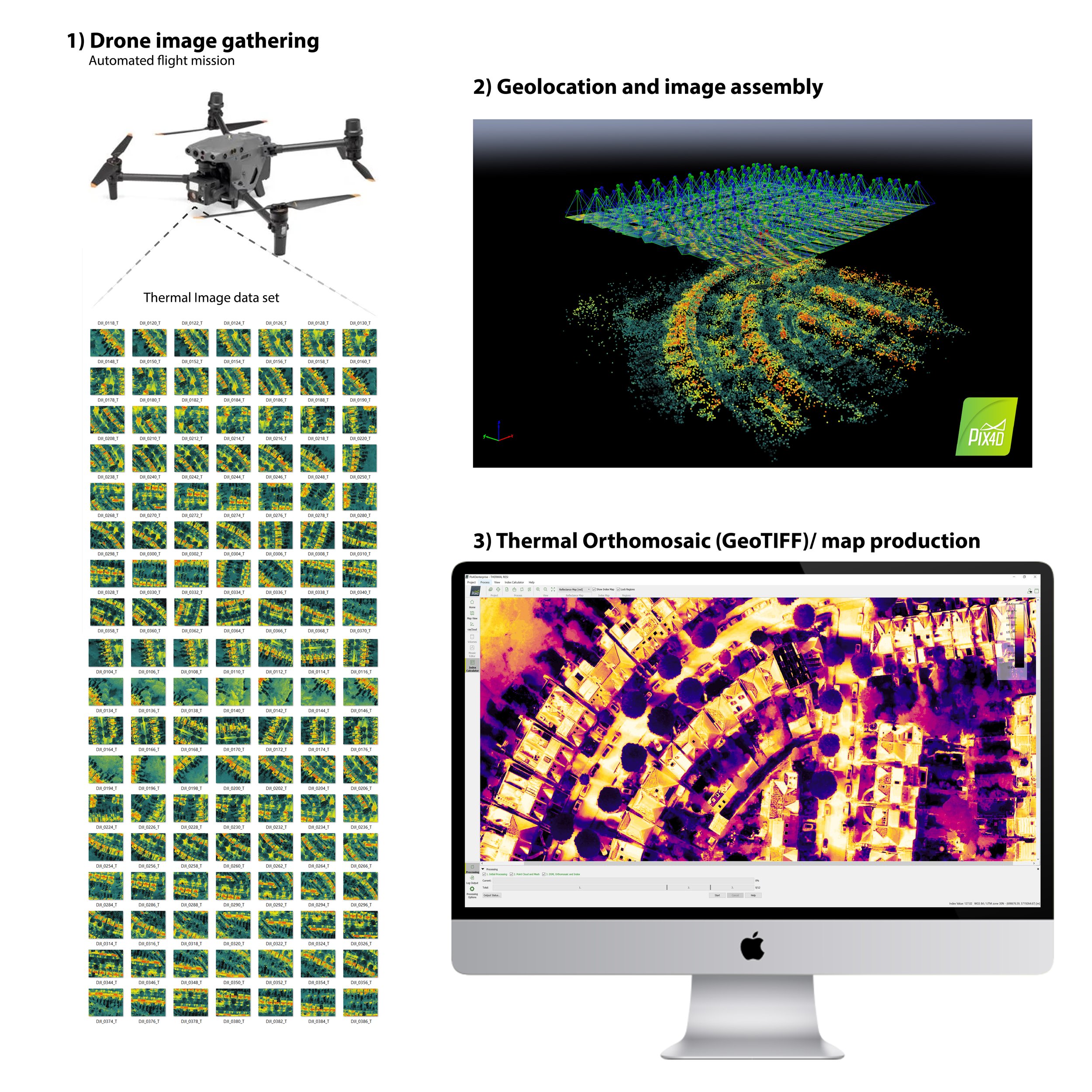
The architect uses its out thermal mapping imagery obtained thanks to drones, to evaluate heat island effect and plan public spaces, or residential blocks to be located in areas with lower surface temperatures.
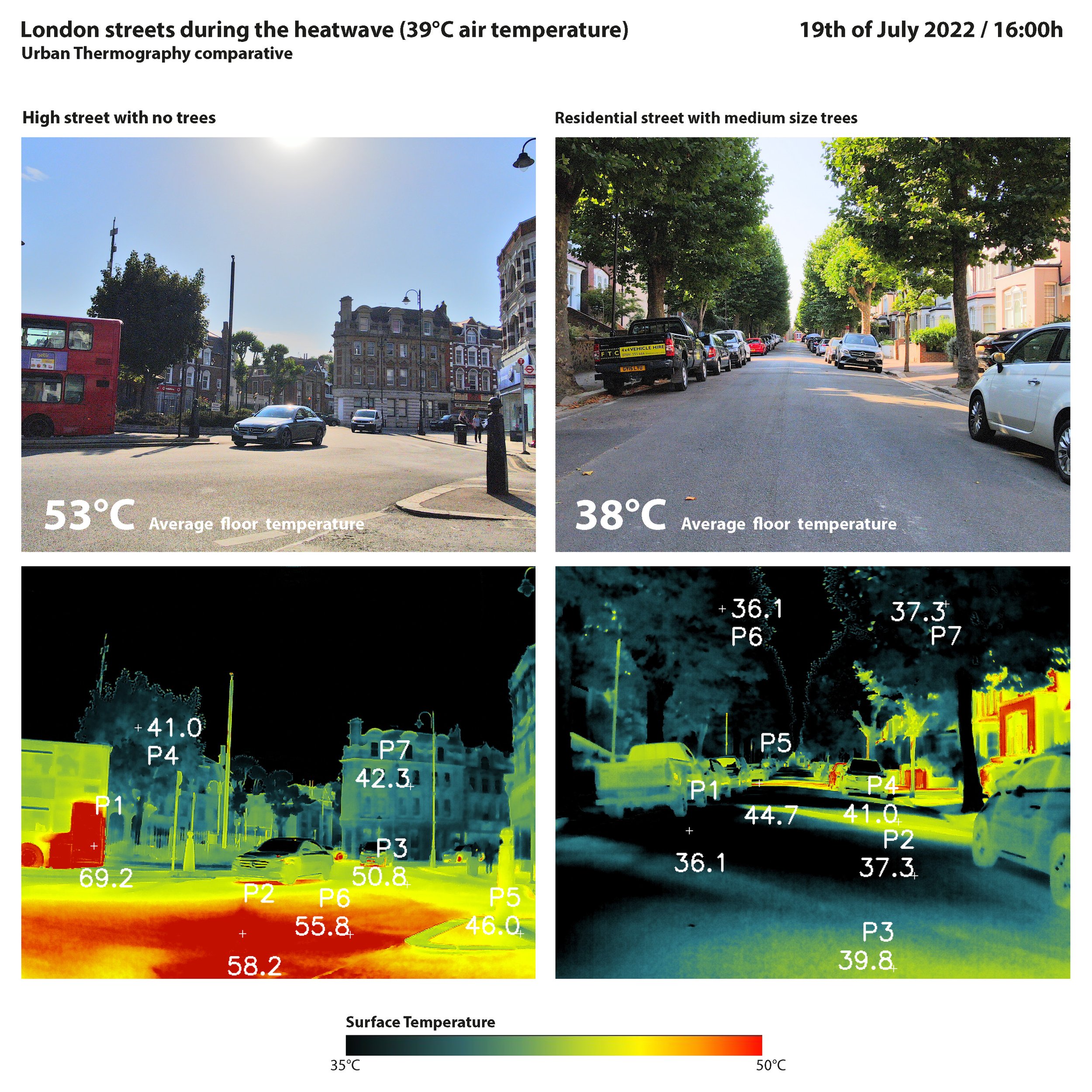
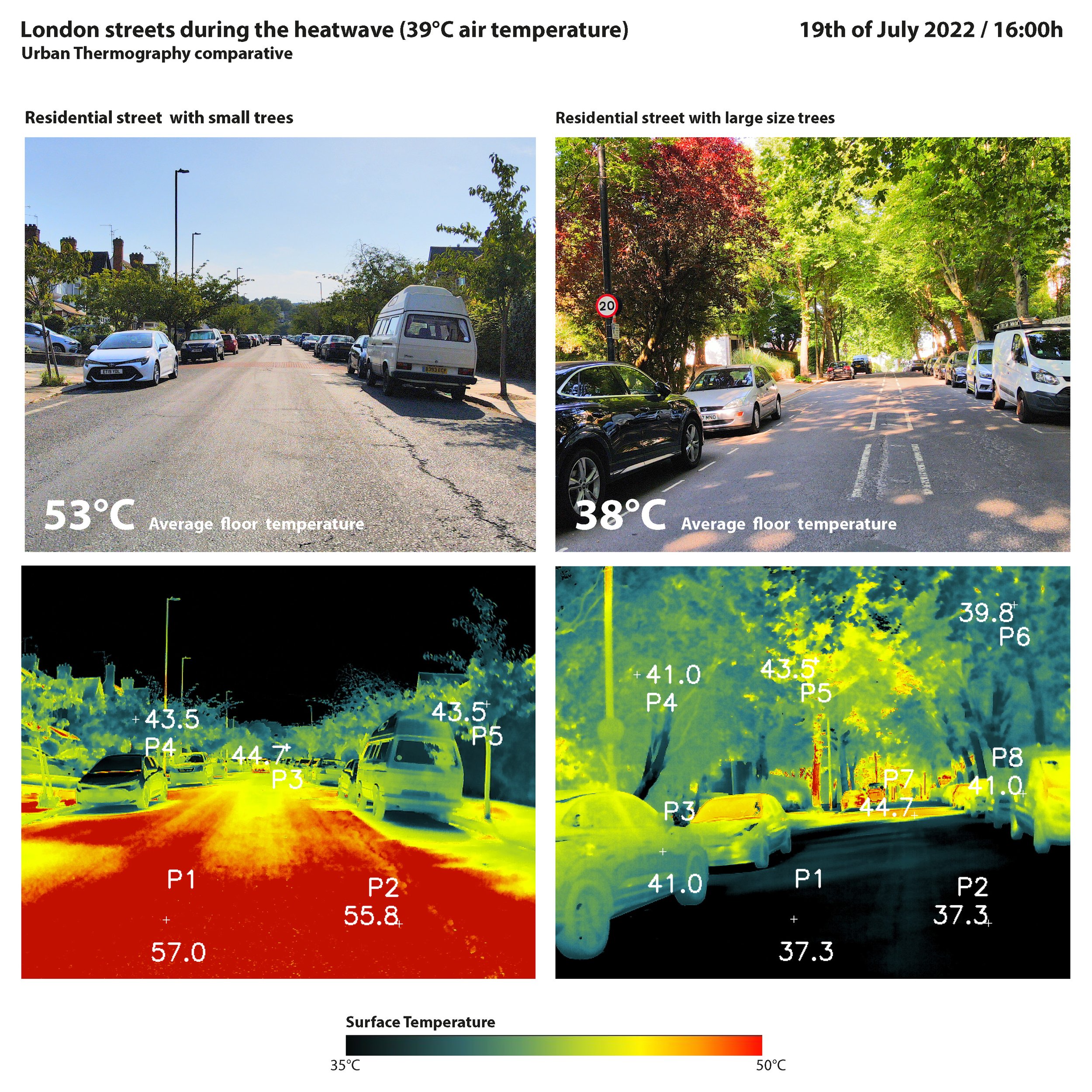
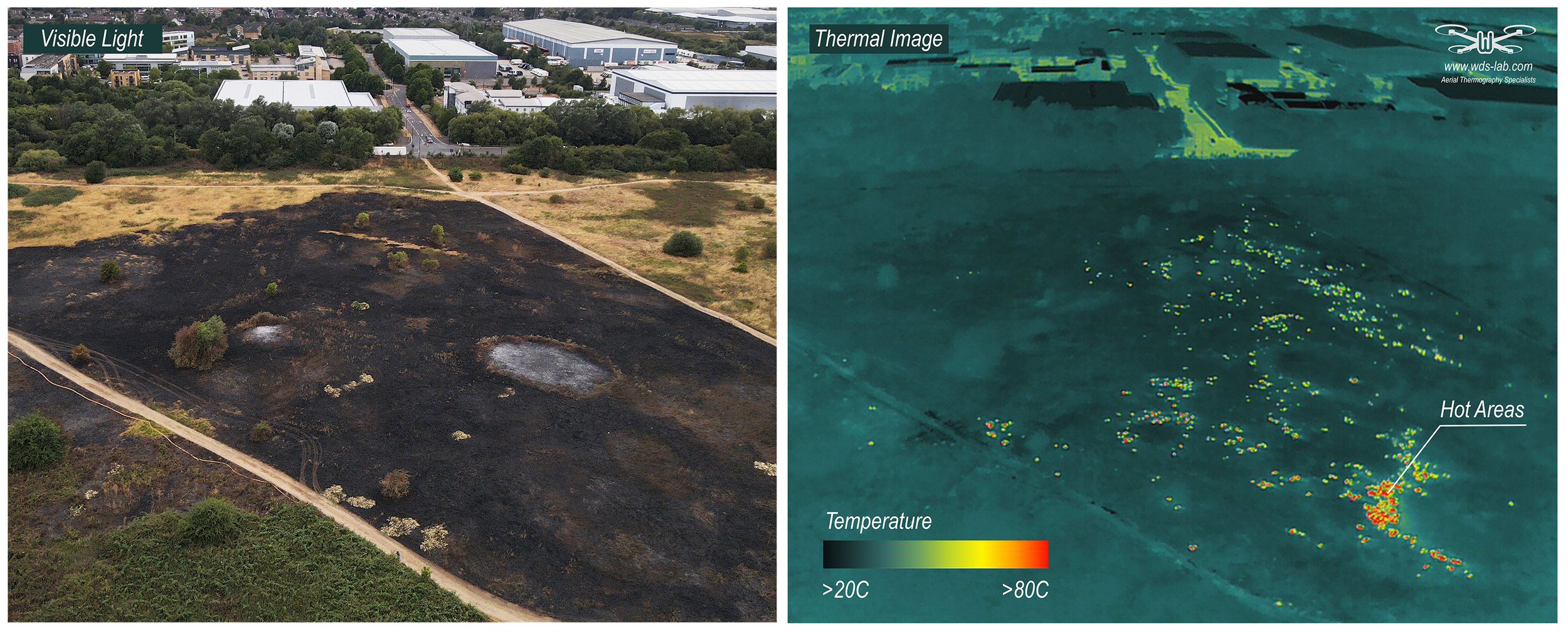
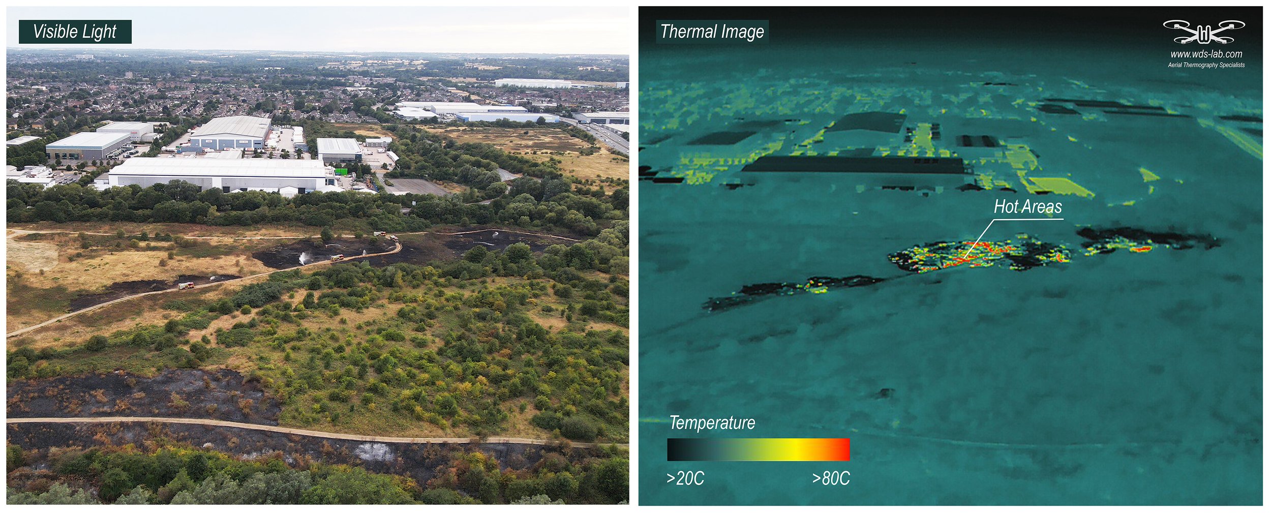
An example of his work was the thermal footage obtained over the same dates this summer, by his studio, in the city of London. Londoners suffered the first red alert of its history, due to a heat wave, Bausá´s architecture Studio checked the great impact of vegetation to mitigate these temperatures.